


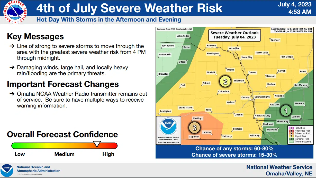
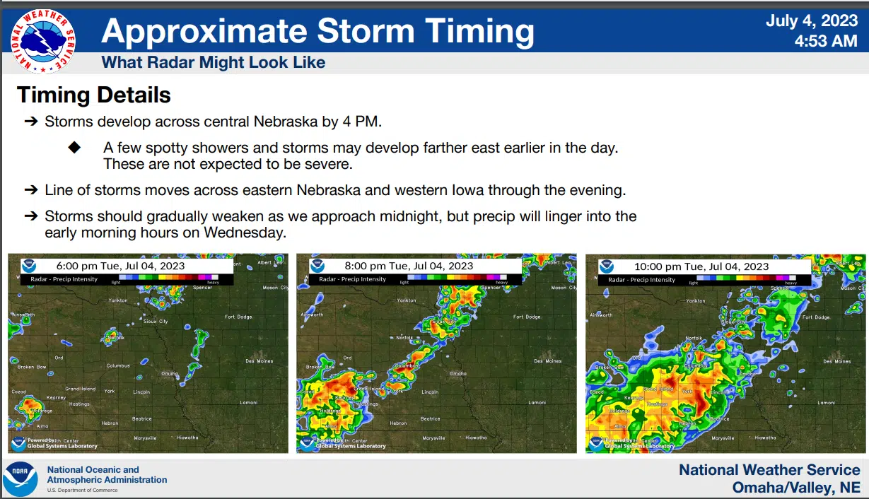
 Strong and possibly severe thunderstorms are expected to develop in northeast Nebraska by 3 to 5 pm this afternoon, then develop and spread southward through the remainder of the region through the evening as a cold front moves into the area.
Large hail and damaging winds are the primary hazards with a few storms later today, but locally heavy rainfall will also be possible.
There is a slight risk of excessive heavy rainfall which could lead to localized flooding. Most of the region is at a slight risk for severe storms, with areas from Crete to Fairbury in southeast Nebraska in an enhanced risk area. The severe weather risk should shift south into Kansas and Missouri after midnight.
Additional Information from the National Weather Service is available here 7-4-23 AM NWS DssPacket