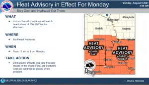
…HEAT ADVISORY FROM NOON TODAY TO 9 PM CDT TUESDAY…
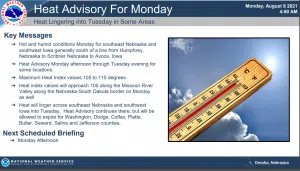
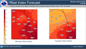
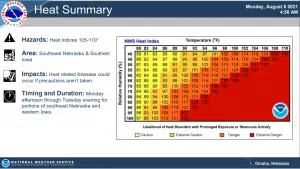
Heat index values up to 108 this afternoon, then cool to only between 75 and 80 tonight. The heat index will again be near 105 Tuesday afternoon and evening. The Advisory covers portions of east central, northeast and southeast Nebraska and southwest Iowa.
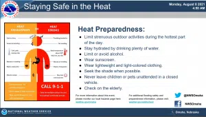
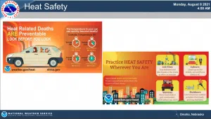
The heat and humidity may cause heat stress during outdoor exertion or extended exposure.
The combination of hot temperatures and high humidity will push the heat index over 100 this afternoon for all of eastern Nebraska and southwest Iowa. Heat indices over 105 are forecast for areas near and south of Highway 30 in Nebraska and Interstate 80 in Iowa, where a heat advisory has been posted.
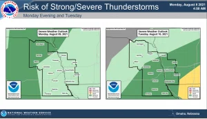
A few thunderstorms are possible late this afternoon and overnight in northeast Nebraska. There is a marginal risk for severe wind gusts with any storms that fire.
Tuesday through Sunday there is a marginal risk for severe thunderstorms over much of eastern Nebraska and southwest Iowa Tuesday afternoon and evening as a weak cold front slides into the area.
Damaging wind gusts are the primary concern. And there is another marginal risk for severe thunderstorms Wednesday afternoon and evening for far southeast Nebraska and southwest Iowa.
Hot and humid weather is forecast to continue into at least Wednesday. A heat advisory remains in effect for areas along and south of Interstate 80 Tuesday afternoon and evening when heat indices near 105 are expected. We could see similar conditions on Wednesday.